
Southern Scottsdale Character Area Plan
 What Is It?
The Southern Scottsdale Area Plan contains policies and guidelines that strive to preserve neighborhoods and character in the southern portion of the city. The policies and guidelines establish the initial minimum threshold for a project to be considered in Southern Scottsdale.
City Council adopted - October 2010
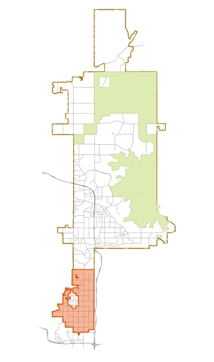
Where Does It Apply?
The Southern Scottsdale Character Area is bound by Indian Bend Road to the north, the southern city boundary, the western city boundary and the eastern city boundary. The Downtown area falls within this character area, but is not included, as it is it's own distinct character area.
Southern Scottsdale Character Area Map (PDF)
Why Was It Developed?
The City of Scottsdale adopted theSouthern Scottsdale Character Area Plan on October 26, 2010. The area encompasses approximately 14 square miles of the southernmost portion of the city, south of Indian Bend Road.
At the time of adoption, this area contained approximately 30% of Scottsdale’s population. Furthermore, most of the housing stock and commercial facilities in this area are 30 or more years old, which made it important to preserve and protect these neighborhoods while still moving towards tomorrow.
The Southern Scottsdale Character Area Plan is an area - specific policy document that will be utilized in implementing the community’s goals for this area.
Related Resources:
- Scottsdale General Plan 2035
- Multi-Family Development Activity 2010-2016 (PDF)
- Real Estate Economic Analysis of Use Options in Southern Scottsdale (PDF)
- Every House Changes (PDF)
- Neighborhood Planning
- Citizen Service
- Before & After Development (2020)
- McDowell Road Corridor Facts & Figures (End of Year 2017)
- McDowell Road Corridor Facts & Figures (January 2006 - June 2016)
- McDowell Road Corridor 10-Year Resale Housing Analysis (January 2006 - June 2016)
Contact Information
Adam Yaron
Planning & Development Area Manager
P: 480-312-2761
Email: [email protected]
Taylor Reynolds
Principal Planner
P: 480-312-7924
Email: [email protected]
Southern Scottsdale CAP Chapters
- Cover and Table of Contents (PDF)
- Executive Summary (PDF)
- Vision Statement (PDF)
- Land Use (PDF)
- Character and Design (PDF)
- Economic Vitality (PDF)
- Neighborhood Revitalization (PDF)
- Housing (PDF)
- Community Mobility (PDF)
- Public Services & Facilities (PDF)
- Open Space & Recreation (PDF)
- Preservation & Environmental Planning (PDF)
- Glossary (PDF)
- Related Documents (PDF)
- Implementation Programs (PDF)